How Dense Is Your City

New year means new web applet! As a recovering architect, I still spend some of my days thinking about the built environment and our urban fabric. And as a product designer, I spent some of my days developing tools to synthesize my thinking. "How Dense Is Your City" is the result of some recent thoughts on urban density. "How Dense Is Your City" is a simple yet powerful tool to explore how cities use their land to house and support their residents.
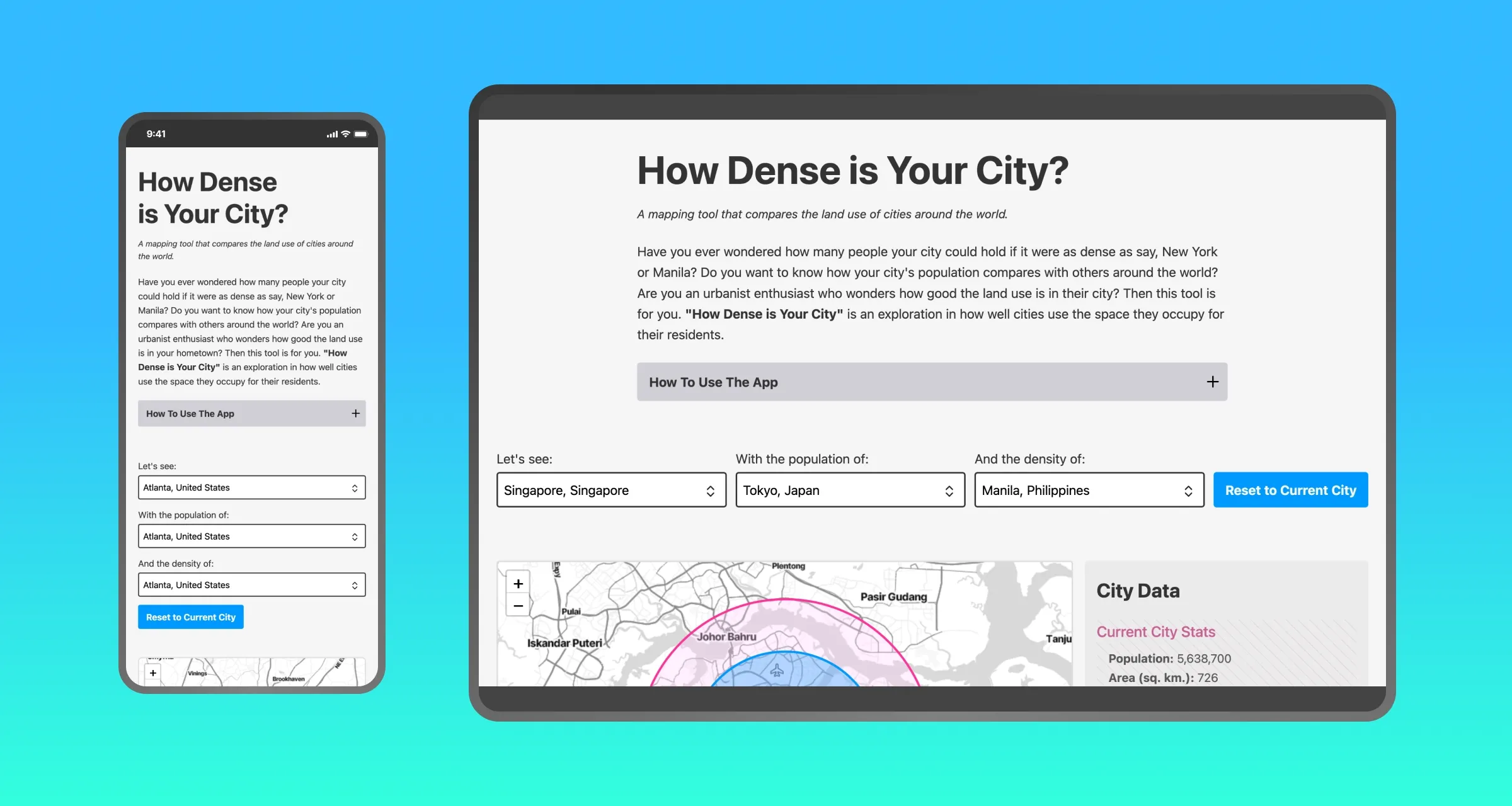
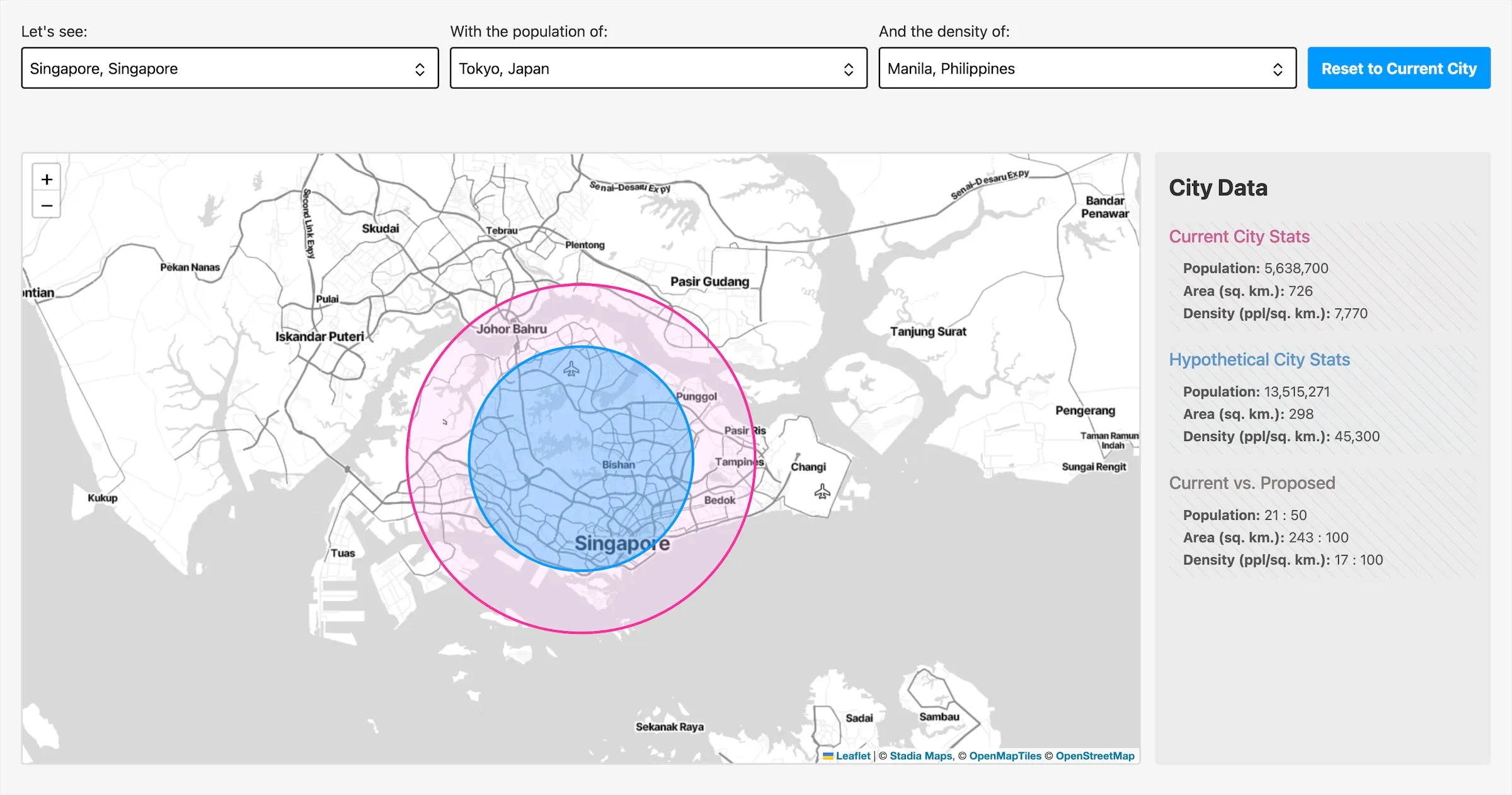
Using the app, you can compare the population densities of different cities around the world. The app allows you to visualize the land area of an existing city (represented as a circle) and compare it with the area of a hypothetical city. The hypothetical city can have the population of a different city, a population density of another city, or a different combination of both. With over 80 cities available in the dataset, you have almost 100 thousand combinations of locations, populations, and densities to explore. You can see how large New York would be with Tokyo's population, or how much land Paris would take up if it were as dense as Manila, or how Cairo would look with Lagos's population and Singapore's density. Feel free to visualize to your heart's content.
The applet is written in Svelte 5, and the map is powered by Leaflet. The data sources used in the app include:
- Wikipedia - List of Largest Cities
- CityDensity
- Huwise Data Hub - GeoNames, All Cities with a Population of 1,000+
"How Dense Is Your City" is a continuation of my previous work on land use -- CYBOTL and The Setback Visualizer. Hopefully, the app can give people insight into how their cities engage their urban fabric and how they can improve their land use. If you have any questions or comments, send me a message.